
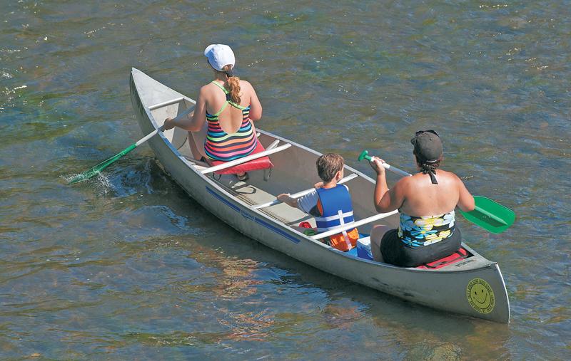
As I kayak the Huron River from Argo Pond to the Gallup Livery, the gently sweeping curves in the river have me daydreaming of deep wilderness. The banks hang thick with trees, sporting a lone eagle perched high. Turtles sun on mossy dead branches poking above the water’s surface. A patch of white trillium on a shaded bank heralds spring, and a deer with her twin fawns fords the clear, shallow waters up ahead.
A sign overhead on the Fuller St. bridge tells me Lake Erie is 49.1 miles away, a reminder there’s more to the river than my immediate view. Way more. And it’s not just the river that’s vital. The land surrounding the 125 miles of the Huron has a direct connection to the river’s well-being, making–or breaking–my wilderness dreams.
The Huron River watershed encompasses 908 square miles, touching seven counties and sixty-three municipalities, from the Huron Swamp in northern Oakland County all the way to Lake Erie. In addition to the Huron’s main stem, the watershed includes 370 miles of tributary creeks and streams, and 300 lakes. Everything that touches them affects the river and our water quality.
—
No sooner had Europeans settled in the watershed two centuries ago than they began reshaping it. They cut down forests for farms and homes, and dug extensive diversion ditches to drain wetlands.
Some of the farm fields they created are tilled to this day. Others have reverted to woods, or been developed in subdivisions. But those wetlands had provided essential habitat for a diverse range of plants and animals, capturing rainwater and replenishing aquifers. Their loss is still felt.
In other ways, too, the watershed was long an abused servant in our pursuit of progress. Between 1824 and 1925, no less than nineteen mills and factories dotted the land near the Huron River. Pipes dripped industrial spillage onto the land and water.
“Before, the rivers were ugly and forgotten,” says Laura Rubin, executive director of the Huron River Watershed Council (HRWC).
Ann Arbor began treating its sewage only in the 1930s, and as the city’s population grew–it tripled between 1940 and 1970–the plant was overwhelmed. By the mid-1970s, it was spewing raw sewage into the river a dozen times a year. It took a court-ordered moratorium on sewer hookups to finally get a second plant built.
By then, the 1972 Clean Water Act had forced communities and industries to get serious about prevention, reduction, and elimination of pollution. And governmental and non-governmental organizations issued a call to arms to the public to get involved.
“Public education is just so important,” says Bob Grese, director of the U-M’s Matthaei Botanical Gardens and Nichols Arboretum. It helps “people see the relationship of their actions to water quality and water abundance in the river. People knowing that this is where our drinking water comes from is a good motivation.”
In 2002, the city contracted with HRWC to share a “pledge book” with more than 20,000 households. It asked residents to take actions to protect water quality, from changing lawn care practices by using fertilizers with less phosphorus to more careful disposal of home toxics. A follow-up survey found that “90% of respondents report having a greater awareness of the issues covered in the pledge book, with over 60% reporting changes in daily or weekly practices related to water and the environment.”
Excess phosphorus results in algal blooms that can completely block the sun from waters below, causing eutrophication, or dead zones, in bodies of water. In recent years, it’s caused toxic blooms in Lake Erie–one shut down Toledo’s municipal water supply for two days in 2014. Earlier this year, the Ohio EPA declared the entire western basin of Lake Erie “impaired.”
HRWC has been working on the problem for decades. In the mid-1990s, it collaborated with the Michigan Department of Environmental Quality (MDEQ) to implement a phosphorus reduction plan, mostly by discouraging the use of phosphorus fertilizers in river communities.
It worked: according to HRWC watershed planner Ric Lawson, between 1995 and 2003, the number of tons of phosphorus reaching Ford Lake dropped from 36.6 tons to 29.1 tons. After Ann Arbor banned the sale of phosphorus fertilizer in 2007 “and some major investment in storm water improvement,” Lawson emails, by 2014 “the watershed phosphorus load to Ford Lake was down to 22.4 tons per year, a 23 percent reduction from 2003 loads.”
—
But no efforts, no matter how noble, run in only a positive direction. While urban tributaries like Malletts Creek have seen steady decreases in phosphorus concentrations, loads in the Huron have held steady in the agricultural Mill Creek watershed, and increased in the rural/suburban areas upstream of Washtenaw County.
The reason for the disparity is that agriculture is exempt from the phosphorus ban. The HRWC is starting an EPA-funded initiative whereby agricultural companies will be paid if they provide benefits to area water health by reducing phosphorus use.
In the 2010s, Ann Arbor replaced its original 1930s sewage plant. But problems persist despite best efforts: in June, a manhole leak dumped 300,000 gallons of sewage onto the Dow Prairie of Nichols Arboretum. Ironically, the overflow was allegedly caused by rope left behind after a contractor inspected the pipe. Grese said the majority of the spill seeped into the prairie’s sandy soil, an area where “dense native grasses can tolerate it best by taking up nutrients.” He says that a year-long sewer relining project will prevent future spills.
—
The Gelman dioxane plume is perhaps the most loathed of recent watershed pollution issues. Water containing the suspected carcinogen was first dumped by a Scio Township factory in the 1960s, and continued for twenty-some years before the company acted to stop it. At the time, the regulations that would have called for monitoring the problem didn’t even exist. Now, the dioxane plume is out there, moving slowly through groundwater. Rubin says the plume will reach the Huron River eventually, but the level of contamination will likely be so low the water will still be within safe standards. But the pollution story illustrates how poorly we treated our land and waters until recently, and how attitudes have shifted.
One symbolic change came a decade ago when the county’s “drain commissioner” became its “water resources commissioner.” While no one is calling for undoing the 19th-century farmers’ drainage system, protecting the wetlands that remain is now a priority. “We’ve done a lot of work on wetland protection and some on restoration,” says Rubin. “We’ve worked to pass wetland ordinances at the local level and strengthen Michigan’s wetland protection laws.”
Two converging trends–one economic, the other environmental–have made that more urgent. Wetlands and natural areas catch and filter rainwater, so that more is absorbed into the land. But as more of the watershed has been developed, impervious roads, buildings, and parking lots instead send it rushing into drains, which in heavy downpours can overflow and cause neighborhood flooding. In southwest Ann Arbor, where 36 percent of the watershed is impervious, streets briefly turned to rivers during a storm in 2014.
“And our relationship with rain is changing,” says Rubin. “The amount of precipitation is increasing because of climate change.”
—
One way to mitigate those risks is to build rain gardens–depressed plots that catch and filter storm waters. The water resources commissioner provides support and advice to citizens building private rain gardens, and a few years back the city incorporated small curbside gardens into a reconstruction of Miller Ave.
It’s also built much larger ones. On a recent walk by Dolph Park, I spied an impressive new rain garden. Colin Smith, the city’s recreation services manager, emails that it originated in a 2014 vote by the Parks Advisory Commission “recommending that City Council secure funding for feasibility and design efforts to retrofit the Lakeview Drive outfall that discharges into First Sister Lake to enhance water quality through increased sediment trapping and nutrient uptake. This retrofit enhances the water quality and ecological health of the Sister Lakes. It can also positively affect the Huron River due to the fact that drainage from the Sister Lakes reaches it.”
In a related story, Rubin told me that the U-M, a reluctant participant in the past in implementing mitigation systems, has begun its central campus storm-water infiltration system in front of the art museum and Angell Hall, slated for completion in fall 2018. The 182- foot-wide structure will support 750,000 gallons of storm-water run-off, slowing sediments and water that previously rushed to the Huron River.
Ann Arbor has 159 pockets of green parks, but the surrounding cemented-over development causes too much storm water to rush through them, eroding the land away. Case in point: Schoolgirls’ Glen in the Arb. Rain run-off flows from parts of the medical campus, some of Washington Heights, and through Forest Hill Cemetery, down the Glen’s ravine and into the Huron River. In the early 2000s, step-pool rain gardens were added to catch and filter the runoff.
However, the planners underestimated how much rainwater flowed down the ravine, and, more importantly, how much sediment would settle in the step-pools. They now must be emptied out periodically. But Grese predicts that upcoming projects will provide a more lasting solution.
“Our goal is not to ‘restore’ Schoolgirls’ Glen to past conditions as that would be impossible,” says Grese. But with funding from DEQ, and collaboration with U-M and the city, mitigation projects such as planting bare slopes, building stone walls, and reducing rain runoff from higher ground should stem the flow down to the Huron.
Other storm-water mitigation techniques are roof gardens, porous paving, and bioswales, (a cousin to rain gardens in which landscaping is engineered to remove debris from rain runoff), all of which are happening at increasing rates in and around Ann Arbor.
HRWC’s Rubin applauds the Toyota Research Institute on Green Rd. for its high standards in managing storm water and green infrastructure. She also cites SavCo owner Sava Lelcaj Farah as forward-looking in terms of the land’s ecological health. Farah’s new Plymouth Rd. restaurant property runs next to Fleming Creek, and she’s working with the HRWC to hold back storm waters there and revegetate the area. These Ann Arbor businesses, along with other corporations, academic institutions, and government agencies, partner in the Middle Huron Initiative which meets twice per year to hammer out new projects.
—
There will no doubt be challenges ahead, but all of the dedicated environment stewards with whom I spoke struck me as extremely optimistic people. They give their all, year in and year out, to help us live in greater harmony with the Huron, so that future generations of kayakers can achieve our clear-watered wilderness dreams.
“Get out and enjoy the river!” Rubin implores.